3D GROUND MOVEMENT & SLOPE STABILITY ANALYSIS
Hampton Roads Bridge-Tunnel Expansion (HRBT)
SUMMARY
For the evaluation and verification of the impact that the slab may have on the existing ITTs, a three-dimensional numerical model using FLAC3D was developed
A damage evaluation was performed as defined by SON and Cording (2005).
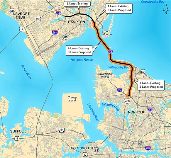
The I-64 Roads Bridge-Tunnel in southeastern Virginia, between the cities of Hampton and Norfolk, has long been one of the most congested corridors of the region. The existing 3.5-mile facility consists of two, 2-lane immersed tube tunnels on artificial islands with trestle bridges to shore. These tunnels opened in 1957 (current westbound lanes) and 1976 (eastbound lanes) and are approximately 7,500 feet long. The Hampton Roads Bridge-Tunnel (HRBT) Expansion Project will ease this congestion by widening the 4-lane segments of the I-64 corridor in the cities of Hampton and Norfolk.
As part of the HRBT Expansion Project and included within the temporary works needed on the South Island, Hampton Roads Connector Partners (HRPC) asked AZIERTA for a 3D ground movement analysis over the existing Immersed Tube Tunnels (ITTs) and a slope stability analysis on the portal island berms.
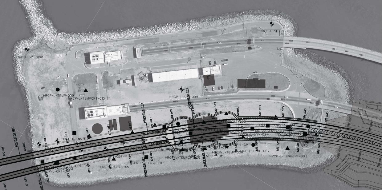
The report deals with the evaluation and verification of the impact that a concrete slab, to be located on the northwest area of the South Island, may have on the existing Immersed Tube Tunnels (ITTs) running underneath. This slab will be used to contain all the equipment needed for a Water Treatment Plant and a Slurry Treatment Plant.
In addition, an analysis of the stability of the existing slopes is carried out considering the load transmitted by the slabs to be executed.